 Indietro
Climate Patterns, Species Distribution, and Ecological Modeling
Guida di studio - Note intelligenti
 Appunti personalizzati basati sui tuoi materiali, ampliati con definizioni chiave, esempi e contesto.
Large-Scale Climate Patterns and Their Biological Implications
Seasonality and Latitude
Seasonality refers to the predictable changes in climate and environmental conditions throughout the year, primarily caused by the tilt of the Earth (23.5 degrees) and its orbit around the sun. The distance from the equator determines the degree of seasonality experienced at a location.
Seasonality: More pronounced at higher latitudes due to greater variation in solar radiation.
Temperature: Influenced by latitude and the angle at which solar radiation strikes the Earth's surface.
Precipitation: Determined by global temperature patterns and atmospheric circulation loops, such as the Hadley cell.
Regions at the equator (0°) tend to be wet, while those at 30° latitude are dry, 60° are wet, and 90° (poles) are dry. Geological features and wind direction, such as rain shadows, also influence local climate.
Rain Shadow Effect
The rain shadow effect occurs when moist air rises over a mountain range, cools, and loses its moisture as precipitation. The air then descends on the leeward side, becoming dry and creating arid conditions.
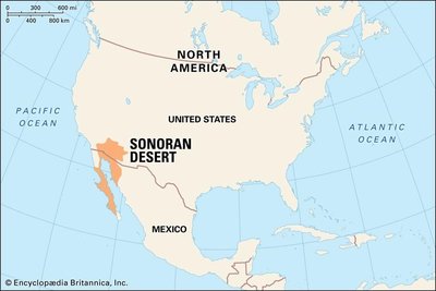
Example: The Sonoran Desert in Arizona is partly a result of rain shadow effects.
Ocean Currents and Climate
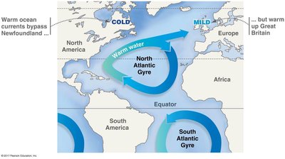
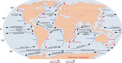
Ocean currents play a crucial role in regulating continental-scale temperature patterns. Warm equatorial water circulates toward the poles, cools, and then returns to the equator. This movement affects coastal climates, making some regions warmer or cooler than expected.
Key Point: The east coast of North America is warmed by ocean currents, while the west coast is cooled.
Example: The North Atlantic Gyre warms up Great Britain, while cold currents bypass Newfoundland.
Predicting Climate and Biological Distribution
Understanding seasonality, latitude, geological structures, continent position, and ocean currents allows scientists to predict climate. Predicting climate enables the prediction of which organisms can live in a given area, as climate determines the distribution and abundance of species.
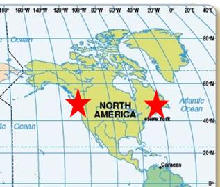
Example: Comparing Seattle, WA and Portland, ME (same latitude, different coasts) demonstrates how ocean currents and continental position affect local climate.
Species Distribution Modeling and Ecological Niche Modeling
Factors Controlling Distribution and Abundance
The distribution and abundance of organisms are controlled by both abiotic (non-living) and biotic (living) factors. Abiotic factors include temperature, precipitation, and physical geography, while biotic factors include interactions such as competition, predation, and disease.
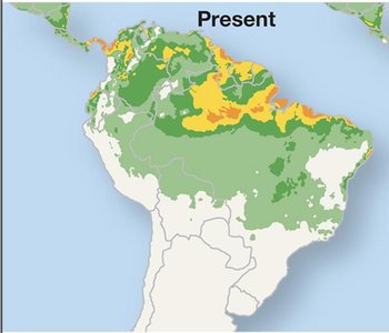
SDM (Species Distribution Modeling): Uses spatial analysis and GIS to predict where species can live based on environmental variables.
ENM (Ecological Niche Modeling): Identifies the range of environmental conditions suitable for a species.
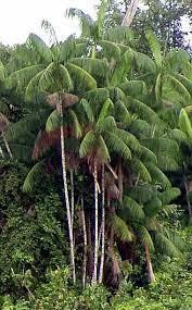

Limitations of Abiotic-Only Models
Many ecological models only consider abiotic factors, which can limit their predictive power. Biotic factors such as seed dispersers, diseases, and competition are often not included, but they can significantly affect species distributions.
Example: Will a toucan seed disperser be present in predicted areas? Will fungal disease or competition change?
Case Study: Climate Change and the Distribution of Açaí Palms
Hypothesis Testing in Ecology
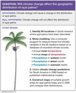
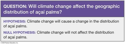
Ecologists use hypothesis testing to predict how climate change will affect the geographic distribution of species. For açaí palms, the hypothesis is that climate change will alter their distribution, while the null hypothesis is that it will not.
Study Design and Modeling Approach
The study design involves identifying locations where açaí palms are found, using niche modeling to measure climate variables, obtaining climate change predictions, and constructing maps of suitable growth areas.
Variables: Annual mean temperature, annual range of temperature, precipitation in wettest and driest months, precipitation in warmest month.
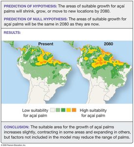
Modeling: Computer models predict suitable areas for açaí palms in the present and in 2080.
Results and Conclusions
The model predicts that the areas of suitable growth for açaí palms will change by 2080, with some areas expanding and others contracting. However, factors not included in the model, such as biotic interactions, may reduce the range of palms.

Factor | Abiotic | Biotic |
|---|---|---|
Temperature | ✔ | |
Precipitation | ✔ | |
Seed Dispersal | ✔ | |
Disease | ✔ | |
Competition | ✔ |
Summary
Understanding large-scale climate patterns, ocean currents, and ecological modeling is essential for predicting the distribution and abundance of organisms. While abiotic factors are often the focus of models, biotic interactions are equally important and can significantly alter predictions. Climate change is expected to impact species distributions, as illustrated by the case study of açaí palms.
Key Equations
Annual mean temperature and precipitation are often calculated as:
where and are the monthly temperature and precipitation values, respectively.
Additional info: Expanded explanations of climate patterns, ecological modeling, and the importance of biotic factors were added for academic completeness.
