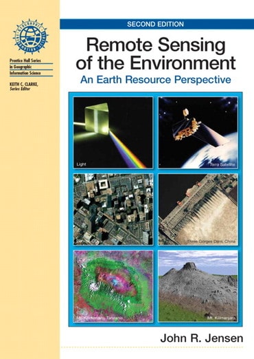
Remote Sensing of the Environment: An Earth Resource Perspective, 2nd edition
Title overview
For one-semester courses in Introductory Remote Sensing as well as Introductory Airphoto Interpretation.
This widely adopted book introduces the fundamentals of remote sensing from an earth resource (versus engineering) perspective. Emphasis is on turning remote sensing data into useful spatial biophysical or socio-economic information that can be used to make decisions.• Thorough review of the nature of electromagnetic radiation:
— Examines how the reflected or emitted energy in the visible, near-infrared, middle-infrared, thermal infrared, and microwave portions of the spectrum can be collected by a variety of sensor systems and analyzed.
• Multidisciplinary approach:
— Emphasizes how to remotely sense fundamental biophysical characteristics of the terrain such as precise location (x,y), height-depth (z), temperature, moisture content, chlorophyll content, surface roughness, etc., for vegetation, soils, minerals, water, ice, and the urban environment.
— Enables readers from many disciplines such as geography, agriculture, forestry, marine science, and geology to adapt the remote sensing principles and technology to their own application. For example, the principles associated with remote sensing of vegetation can be applied to agriculture, wetland, and/or forests. Methods of extracting urban infrastructure and population characteristics are of value to geographers, urban planners, transportation engineers, etc.
• Visually stimulating, clear format:
— The text’s large (8.5”x11”) format includes 48 pages of color facilitates image interpretation. Most remote sensing textbooks have a small format with small remote sensing examples that are difficult to interpret.
— Hundreds of specially designed illustrationscommunicate principles in an easily understood manner.
• Emphasis on manual, visual image analysis of the remote sensor data using introductory photogrammetric techniques:
— Digital image processing methods are described in detail in Dr. Jensen's companion volume, Introductory Digital Image Processing (Prentice-Hall, Inc., 3rd Edition, 2005).
— Takes the approach that the detailed digital image processing principles should be taught in a separate course, not in the introductory remote sensing or airphoto interpretation course.
• Coverage of the history of photography and other remote sensing detectors, and aerial platforms (balloon, kite, aircraft, satellite):
— Encouragesreaders to appreciate the great strides that have taken place in sub-orbital and orbital remote sensing science.
• Case studies in most chapters that demonstrate the proper application of remote sensing principles and technology.
• Practical applications of principles throughout the text:
— Examples include remote sensing of vegetation biomass, chlorophyll a mapping, pollution monitoring, digital elevation model creation, surface temperature measurement, and land-use mapping.
• Two new chapters:
– Chapter 10 (LIDAR Remote Sensing) introduces the fundamental principles associated with this powerful new type of remote sensing that provides detailed digital elevation and vegetation information.
– Chapter 15 (In situ Spectral Reflectance Measurement) describes how to collect in situ spectral reflectance measurements with a handheld radiometer in support of remote sensing studies. Few books have detailed chapters on these two very important topics.
• Unique, high-resolution PowerPoint slides of almost every illustration in each chapter from the author.
– Adopters simply contact Dr. Jensen via email and he makes the lecture plus exercise materials available free of charge via the internet.
– Remote sensing educators throughout the world have found these resources to be of significant value. No other textbook offers such a service free of charge.
Table of contents
1. Remote Sensing of the Environment
2. Electromagnetic Radiation Principles
3. History of Aerial Photography and Aerial Platforms
4. Aerial Photography - Vantage Point, Cameras, Filters, and Film
5. Elements of Visual Image Interpretation
6. Photogrammetry
7. Multispectral Remote Sensing Systems
8. Thermal Infrared Remote Sensing
9. Active and Passive Microwave Remote Sensing
10. LIDAR Remote Sensing (new)
11. Remote Sensing of Vegetation
12. Remote Sensing of Water
13. Remote Sensing the Urban Landscape
14. Remote Sensing of Soils, Minerals, and Geomorphology
Index
Appendix A-Sources of Remote Sensing Information